Esquimalt, B.C.—Tsunami awareness is the focus of a B.C.–wide emergency preparedness campaign starting April 10.
The last major tsunami to hit B.C. shores was on March 27,1964 when Port Alberni was inundated with water following the 9.2M Great Alaska Earthquake.
 In Greater Victoria, the most dangerous tsunami threat will follow a major earthquake.
It’s important that residents are aware of hazard areas, are prepared in the case of evacuation and are signed up to alert systems—like the township's emergency notification system, Esquimalt Alert—to help them receive emergency information.
The Capital Regional District (CRD) and its project partners—including the Township of Esquimalt— recognised the need for detailed inundation mapping from tsunamis for the capital region and commissioned the Capital Region Coastal Flood Inundation Mapping Project.
The resulting tsunami mapping is based on 11 different tsunami sources that may cause tsunamis in our region, including, different magnitudes and sections of the Cascadia Subduction zone, Aleutian Trench, Alaska, Haida Gwaii, Devil’s Mountain Dault, and Southern Whidbey Fault.
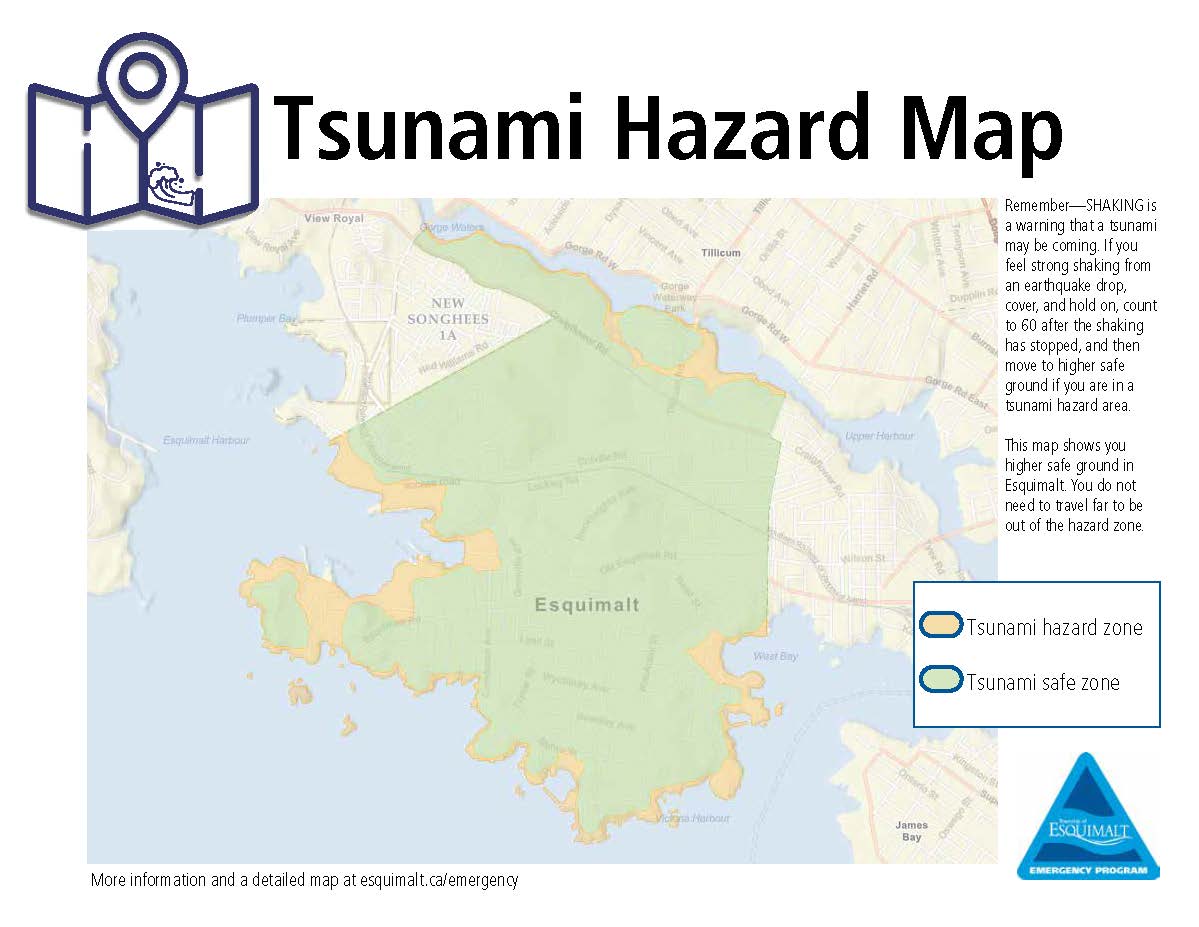
Esquimalt residents can view this latest tsunami map at Esquimalt.ca/emergency. The map indicates hazard zones and safety zones for the township’s shorelines and surrounding areas.
Through April 10-16, the township will promote preparedness through tips, quizzes and other resources on social media.
For more information download a Tsunami Information brochure or pick-up a brochure at one of the municipal facilities.
-30-
Contact
Tara Zajac, Manager of Communications
Tara.zajac@esquimalt.ca
250-414-7122